Orders may be made by email to [email protected].
Prices
- £40.00 per sheet
- £36.00 per sheet if all six sheets ordered
View an outline plan of the six sheets here.
Post and packing in stout cardboard tubes varies with the number of maps ordered but averages £6.
Prices for custom sheets of individual villages, groups of parishes or areas using adjacent sheets are available on request.
There is also available:
- The whole of London: £40
- Centre of London: £25
- The River Thames: £45
The digitally redrawn map is registered for copyright.
Please note that in the North West map the map plate obscures the parishes of Chartridge, Hawridge and The Lee.
Whole map in booklet form
Map of the whole of London and its environs in six sheets in an A4 size booklet with explanatory notes. The sheets are 68cm × 56cm, giving a scale of 1 inch to 0.85 miles. Each sheet slightly overlaps its neighbour, so reducing the risk of a village being ‘on the edge’.
Cost £48
ISBN 978-0-9566198-8-4
ISBN numbers
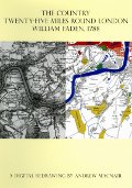
Digital redrawing of William Faden’s 1790 map of the Country twenty five miles around London in ten sheets.
| ISBN | Title | Price in pounds sterling |
|---|---|---|
| 978-0-9565232-0-4 | North West London sheet | £28 |
| 978-0-9565232-1-1 | North Central London sheet | £28 |
| 978-0-9565232-2-8 | North East London sheet | £28 |
| 978-0-9565232-3-5 | South West London sheet | £28 |
| 978-0-9565232-4-2 | South Central London sheet | £28 |
| 978-0-9565232-5-9 | South East London sheet | £28 |
| 978-0-9565232-6-6 | Whole of London sheet | £40 |
| 978-0-9565232-7-3 | Central London sheet | £25 |
| 978-0-9565232-8-0 | River Thames sheet | £45 |
| 978-0-9566198-8-4 | Whole of London in six sheets in booklet | £48 |
Publisher: Andrew Macnair.
Other county maps
You may also be interested other county maps digitally redrawn by Andrew Macnair:
- Chapman André’s 1777 Map of Essex
- William Faden’s 1797 Map of Norfolk
- Dury and Andrews’ 1766 Map of Hertfordshire
- Joseph Hodskinson’s 1783 Map of Suffolk
- Thomas Jefferys’s 1788 map of Buckinghamshire*
- Ordnance Survey Old Series Cambridgeshire (1805-1836)*
- Richard Horwood’s 1799 Map of London
*Details of these maps will follow, for now please email [email protected] for further details and prices.